What the Sand Is Trying to Tell Us: The Science Behind America's Shifting Shorelines
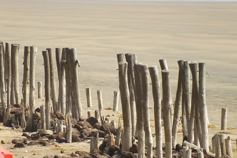
Photo: SOUMITRA GIRI, CC BY-SA 4.0, via Wikimedia Commons
You probably don't think much about the sand beneath your beach towel. It's just there — warm, a little gritty, maybe tracked into your rental car by the end of the week. But to a geomorphologist, that same stretch of beach is practically screaming information. And right now, a growing number of scientists, city planners, and deeply rooted coastal residents are paying very close attention to what it's saying.
America's shorelines have always shifted. That's not the alarming part. The alarming part — or the fascinating part, depending on your perspective — is how fast the conversation is changing about what those shifts actually mean for the beach towns we love to visit.
Reading the Beach Like a Map
Geomorphology sounds like a word designed to clear a room, but the basic idea is pretty accessible: it's the study of how landscapes form and change over time. On a barrier island or sandy coastline, that means tracking how sand moves — where it piles up, where it disappears, and what those patterns tell us about what's coming next.
Dr. Abby Sallenger, a coastal scientist who spent decades with the USGS studying storm impacts on barrier islands, once described the process as reading a newspaper that's being written in real time. The dunes, the berm (that raised ridge of sand just above the waterline), the width of the dry beach — all of it is data.
When dunes start migrating landward without rebuilding seaward, that's a sign the beach is in retreat. When the berm gets consistently narrower after storms and doesn't recover between seasons, that's another red flag. Coastal scientists use aerial imagery, LiDAR surveys, and long-term monitoring stations to track these changes over years and decades — building a picture of which beaches are gaining ground and which are quietly losing it.
The Towns That Are Paying Attention
In places like the Outer Banks of North Carolina, this isn't abstract science — it's deeply personal. Communities on Hatteras Island have watched roads disappear into the surf. In some areas, the island has migrated so far west that old infrastructure now sits in the water. Local planners have had to make hard calls about where to invest in roads and utilities, and where to essentially let the sand win.
Further north, Cape Cod is having a similar reckoning. The outer arm of the Cape — particularly around Truro and Wellfleet — is eroding at a rate that startles even longtime residents. The National Park Service, which manages much of that coastline, has moved away from hard armoring (think seawalls and rock revetments) in favor of managed retreat: letting the shoreline move naturally and relocating infrastructure rather than fighting the ocean.
It's a strategy that sounds simple but is emotionally loaded for the people who live there. When your family has owned a cottage near the bluff for three generations, being told to move back from the edge isn't just a planning decision — it's a grief process.
When Locals Become the Data
One of the more interesting developments in coastal science over the past decade is how much researchers have come to value what longtime residents already know. In communities along the Gulf Coast, particularly in Louisiana and Mississippi, local fishermen and retirees who've spent 40 or 50 years watching the same stretch of shoreline have become informal partners with university researchers.
They remember where the beach used to be. They remember when a particular sandbar disappeared. They know which storms changed everything and which ones the coast shrugged off. That institutional memory — often dismissed as anecdote — turns out to be surprisingly well-correlated with the scientific record when researchers actually sit down to compare notes.
In some Louisiana parishes, community-led mapping projects have combined old photographs, fishing charts, and resident interviews with modern satellite data to create some of the most complete pictures available of how local coastlines have changed over time. It's a reminder that the most useful data isn't always the kind that comes from a drone.
The Tourism Angle Nobody Talks About
Here's where things get genuinely interesting for travelers: the way a beach is changing has real implications for what kind of destination it becomes — and how quickly.
Beaches that are actively eroding tend to lose the wide, flat, crowd-friendly stretches that make them popular in the first place. A beach that was 200 feet wide at low tide twenty years ago might now be 80 feet wide. That changes the whole vibe. It affects parking, it affects the economics of beachfront businesses, and it affects the kind of traveler the town can attract.
Some communities have responded by doubling down on beach nourishment — pumping sand dredged from offshore back onto the beach to maintain its width. It works, but it's expensive (often running into the tens of millions of dollars per project) and it's temporary. The sand doesn't stay put. Destinations like Miami Beach and Virginia Beach have been doing this for decades, essentially buying time while longer-term strategies get sorted out.
Other towns are pivoting their identity. Instead of competing for the wide-beach crowd, they're leaning into what erosion-shaped coastlines actually offer: dramatic bluffs, rocky outcroppings, tide pools, and raw, unmanicured scenery that appeals to a different kind of visitor. It's a harder sell in some ways, but it's an honest one.
What to Watch For on Your Next Trip
You don't need a PhD to start noticing what the sand is doing. Next time you're at the beach, look for a few things:
- Sandbag walls or rock revetments near homes or roads are a sign the shoreline is actively retreating and property owners are trying to hold the line.
- Scarped dunes — those steep, almost vertical dune faces that look like someone cut them with a knife — indicate recent erosion, usually from wave action during storms.
- Overwash fans, those flat sandy aprons that spread across roads or low-lying areas after storms, show where the ocean has pushed water and sediment inland.
- Narrowing beach width compared to old photos you might find at a local historical society or even on Google Street View from a decade ago.
None of these things mean you shouldn't visit. They mean you're visiting a place with a story — and a future that's still being written.
The Bigger Picture
America's coastline is one of its greatest assets, and the communities built along it are some of the most resilient, resourceful, and frankly stubborn places you'll ever visit. The people who live there year-round — not just the summer renters — tend to have a complicated, clear-eyed relationship with the water. They love it. They respect it. And increasingly, they're learning to listen to it.
The sand is always moving. The question is whether we're paying attention to where it's going — and what we're willing to do about it. For travelers, understanding that conversation makes every beach visit a little richer, a little more grounded, and honestly a lot more interesting than just picking a spot and spreading out a towel.
Though there's nothing wrong with the towel part, either.